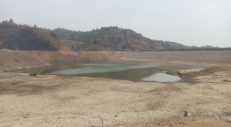
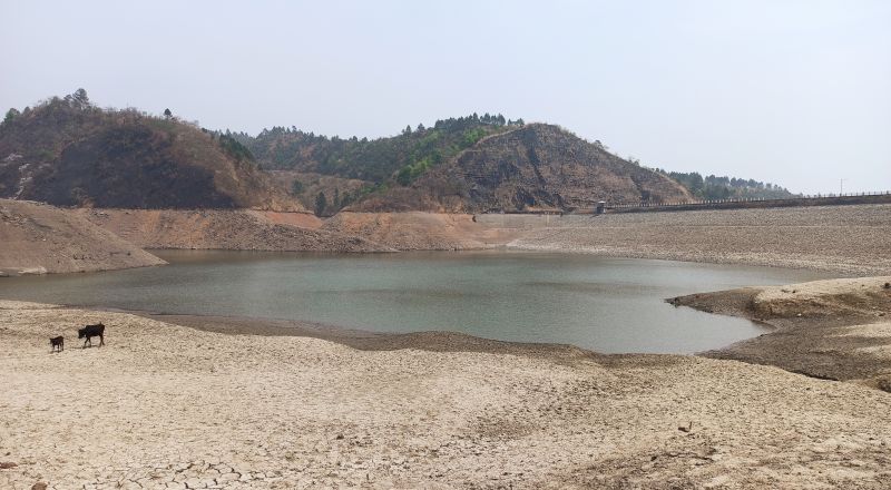
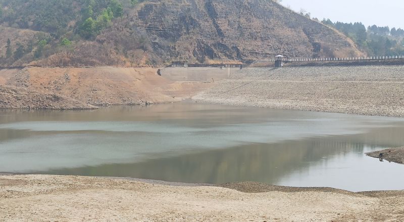
Singda dam, set amidst beautiful verdant low-lying hills and on the Singda river, is reportedly the highest mud dam in the world. Located at Kangchup area, about 19 km from Imphal, the multipurpose dam is projected to provide drinking water supply to Imphal urban areas and irrigation water to an area of 4,148 hectares of agricultural land in Manipur. However, due to the increasing water demand with the expansion of urban areas, rapid urban population growth, changing lifestyle and water use pattern, today the dam serves solely as a major source of drinking water for Imphal valley. It supplies potable water to Imphal urban and its peri-urban as well as adjoining rural areas. It has been supplying 16 to 19 MLD (million litres of water on a daily basis) to Imphal urban and adjoining areas, according to the National Institute of Technology, Manipur. Now, experts warned of water crisis in the state in a month’s time and Singda dam is struggling to meet the water needs of the capital city - Imphal.
Rivers, streams and ponds in the valley areas are drying up. The condition of lakes and wetlands in the state is deteriorating. Degradation of forest areas in the plains and hills are taking place at a fast pace. Owing to it, several places in Manipur is reeling under acute water scarcity, especially during the dry season.
Taking serious note of the concerning issue, the Imphal Free Press has been highlighting the dire situation and the plight of the people in several of its reports.
Building dams is one of the most common approaches of the government in the effort to address the problem of drought and water shortage in a place. The main objective of storing water during the wet season and releasing it during the dry season in order to stabilise water availability may help solve water problem, but increasing water supply due to ever-growing demand for water also have a negative impact on the eco-system and environment of a place.

(IFP_PHOTO)
According to several reports, there is water scarcity in Imphal and its surrounding areas due to the falling water volume at Singda dam. The water supply of 18.16 MLD (million liters per day) to meet the ever-increasing demand has today reduced the water level in the dam. Following it, only 9.5 MLD water from the dam is supplied to the valley urban areas, that also in roster basis.
It may be noted that the Singda catchment area is mainly covered with semi-evergreen vegetation, agricultural-land and inter-montane terrain with a few settlements.
According to climate change impacts on the hydrodynamics of reservoir basin: a case study of the Singda dam, Manipur report, Singda dam is situated at 24.88 degree North and 93.80 degree east and about 20 km towards the west from Imphal. The catchment area of the river up to the dam site is 25.38 square kilometre. The total catchment area of the river up to its confluence with Nambul is 36.36 square kilometre. Six sub-watersheds comprise the Singda dam catchment systems with minor streams.
The dam is mainly fed by three small streams: Singda, Kharam, and Ireng lok (local name of mountain channel).
According to the report, Singda stream is a minor mountain channel flowing from the Sadar Hills sub-division, Kangpokpi district located towards the north-western region of Imphal West district. The stream starts near the Kharam village and Waiphei village at about 1450 MSL and in a south easterly direction through Kadangband and continue further down for about 10 km in the same direction until its confluence with Nambul river near Iroishemba.
Speaking exclusively to the Imphal Free Press, Ngangbam Romeji, assistant professor of Civil engineering department, NIT, Manipur, who studies climate change impacts on the hydrodynamics of Singda dam reservoir basin, said that the year 1974 has the lowest runoff with 229.47 mm and the year 2016 has the height runoff of 643.22 mm. This is due to the lowest rainfall observed with 1150.1mm in the year 1974 and the highest rainfall of 1850mm in the year 2016. Again, in the year 1989 it has the highest evaporation rate of 621.4 mm and in 1960 it witnessed the lowest evaporation rate of 489.0 mm.
Romeji said there is an alarming rise in the catchment sediment yield to the tune of 800.16 tons/hectares in 2016 and in 2009 it was 550.13 tons/hectares. It is attributed to the depleting forest cover and land degradation in a 25.38 square kilometre catchment area.
As per the soil water assessment tool (SWAT), actual evapotranspiration has been increasing as in 2009 it was 575.4 mm, but in 2016 it was 604.1 mm. It indicates a catchment holding more liquid water, Romeji said.
Two hydrological model namely SWAT and topography based hydrological model (top model) indicates a certain degree of correlation, he said.
Reservoir volume (capacity) has been worked out at nearly 20 MCM (million cubic metres), whereas the maximum storage capacity of the reservoir at full reservoir level worked out from the reservoir statistics is 13 MCM. The overflow discharge level at 909 to 910 MSL is 9.8 MCM. It indicates inefficient reservoir planning, he added.
Romeji also spoke on that siltation in the reservoir that the average daily drawdown (water withdrawal for domestic water supply by PHED) is in the range of 18 MLD (million litres per day). On average, storage at 900 MSL means 5.6 MCM, the total water availability should be 5600 million litres. However, the minimum drawdown level in the reservoir affected due to siltation has deterred the water extraction for domestic water supply.
When asked about siltation quantity in the dam, Romeji calculated that sediment discharge in the reservoir is 35gms per day, while the water from Catchment Rivers flows about 1.3 cubic meters per second.
He suggested that the concerned government departments or agencies should have monitored other parameters like siltation rate, which has been reducing the water holding capacity of the reservoir besides the water level.
Year after year, Manipur has been witnessing the incidence of water scarcity, particularly in Imphal city areas. It has been a regular occurrence, Romeji said, adding, “We neither hold back to blame the government nor tried to change our fast-lane lifestyle! With ever-increasing population coupled with exploitation of the river catchment areas (deforestation), mining in the riverbeds, pollution and over-drawing of water from the rivers, the demand-supply gap quotient has also been widening”.

(IFP_PHOTO)
According to T. Brajakumar, deputy director, directorate of Environment and Climate Change, experiencing a shortage of water at this time of year is normal due to deficit in pre-monsoon rainfall. However, the severity has gradually increased over the past few years. This year too, he said, major catchment areas like Tamenglong, Churachandpur, Imphal West and East among others have witnessed over 90 per cent pre-monsoon rainfall deficit.
According to the directorate of environment and climate change rainfall report of Manipur, the total rainfall since 2014 is above 1005.003 mm.
The construction of the multipurpose project dam with a height of 60 m and length of 490 started in 1975 at a cost of Rs 6,814 lakh. It took almost 20 years for the dam construction and it was completed in 1995.
According to official records, in 1975, the government of Manipur acquired 517 acres of Ireng and Kadangband village for the project, which includes prime agricultural land for the construction of canal and water supply. Besides irrigation of the agricultural fields in Kadangband, Chirang, Phumlou, Sanjenbam, Lairensajik, Phayang, Lamsang in Imphal West district, etc, the project also aimed at supplying water to greater Imphal.
The state government also announced the construction of a public garden entitled Brindavan Garden at the foothill areas of the dam vicinity.
How the multipurpose project has failed
However, the multipurpose project has failed its objectives, except for supplying drinking water.
The Brindavan garden are is lying waste in complete shambles. The irrigation project has failed and the power generating unit is lying idle without generating a single unit of power.
It may be mentioned that the dams have affected the people living in both the upstream and downstream areas of the Singda river who are economically poor.
Also, since the dam blocks flowing water, those aquatic animals that depend on the flow to reproduce or as part of their life cycle are put in danger. In addition to this, the beneficial sediments that are normally washed down by the river are blocked, which decreases the fertility of the soil on the downstream side, according to the studies conducted on problems and prospect of dams in Manipur.
According to the study - Dam Rehabilitation and improvement and improvement project (DRIP) II - Environmental and Social Impact Assessment on Singda Dam, the dam is located in Kangpokpi district. Six villages namely Singda, Kangchup Geljang, Kangchup Patbung, Kangchup Khomunnom, Kangchup Tuikon, and Bethel have been identified as falling in a 5 km area on the downstream side of the dam.
It states that there is no protected area within 10 km distance from the dam. The nearest protected area is Bunning Wild Life Sanctuary at a distance of 22.2 km from the dam. Terrace cultivation is generally practiced by the people in these villages.
When this IFP reporter visited the villages, it was found that surrounding villagers are faced with no water problem. They get water from village water tanks and water supply in the district.
It is Imphal areas which is facing water scarcity despite the setting up of the dam.
Further, the state public health and engineering department recently stated that “due to the drastic reduction of water level at Singda dam and drying up of Leimakhong river, which is the main source of raw water, the treatment plants at Singda, Kangchup and Kangchup Extension (WTPs) are unable to produce optimum quantity of treated water.
This reporter also interviewed Ksh Tombi, state executive engineer water supply project construction division, public health and engineering department.
Speaking to IFP, he said people in urban areas of Imphal valley may face drinking water crisis in the next one month if the annual monsoon is delayed as the water level in Singda Dam has reduced to an alarming stage.

(IFP_PHOTO)
Water level of Singda dam is divided into three levels. Of the total dam level of 34 metres, the first level is marked at 10 metres from the top of the dam and another 10 metres at the second level and the last level is marked with 14 metres. If the water level is reduced below the second level, it is considered an alarming stage, he explained.
The government’s effort to plug the problem of water scarcity
As the problem of water scarcity was highlighted, the chief minister of Manipur set up a committee to conduct a survey of water scarcity areas and recommend and monitor steps for meeting the shortage. During the meeting on setting up of the committee, the following quick-fix measures were decided upon:
1. Imphal Barrage would be shut down until the water situation improves
2. Water from Dolaithabi Barrage would be released to Iril River
3. Dredging of riverbeds and dams would be taken up by Water Resources Department
4. PHED would deploy an adequate number of water tankers by hiring from private agencies, etc
5. Commissioning of Chingkheiching Water Supply Project would be expedited
6. Water Resources Department would examine feasibility of constructing multiple low-level barrages on Imphal River, Iril River, Thoubal River, and Kongba River
7. Feasibility of conserving river water during the monsoon through more effective engineering mechanisms such as interlinking of rivers, etc would be explored
8. The scope of utilising the Barak River water would also be explored.
The plan to upgrade dams
Rohit Ahanthem, SC of the Water Resource department, also told the Imphal Free Press that the people’s demand for water is increasing due to changing lifestyles and the rise in population. When Singda Dam was constructed, the quantity is 4 million gellon per day (MGD) and now in view of the ever-increasing demand for water, the department has increased the treatment plant to 27 MGD.
Ahanthem explained that the main source of water in Manipur (rivers) will not remain the same without preserving the catchment areas amid the lack of rainfall. Deforestation is causing the drying up of the catchment area of the river. However, efforts are being made to modernise the dam, he said.
The study under the project called DRIP was started in 2019 in the effort to modernise existing dams.
Under the DRIP project, five dams will be modernised namely Khuga Dam, Singda dam, Imphal Barrage, Sekmai Barrage, and Khoupum dam. Under this project, different studies will continue phase-wise like catchment studies, he said.
Is there a way out?
In the hill areas of the state too, natural sources of water are fast depleting due to rampant deforestation caused by several factors. As a result, the state is facing reduced water security for its growing population.
Experts expressed the view that tribesmen in hills will have to change the way they look at a tree as it provides life giving water for their families and future generation, while the people in the valley should also realise water are not sewerage drains but source of drinking.
Speaking to IFP, environmentalist Salam Rajesh said the drying up of the catchment area is caused by deforestation and pineapple plantation being carried out in the surrounding areas of Singda hill range. Also, pointing out the deficit in the pre-monsoon rainfall deficit this year and abundant rainfall in past years, he emphasised the importance of the relation between rainwater and forest to rejuvenate the catchment area. The natural cycle should be maintained to get water from the natural source like the catchment area or build a check dam in the catchment area, Salam said.
“It is not only the government department to protect and preserve the forest for source of water, the public should also cooperate,” Ahanthem added.
Click Here to Read More Exclusive Reports
ALSO READ:
Water crisis looms large over Imphal valley as Singda Dam water level falls to alarming stage
Can groundwater exploration help ease water stress in Manipur?
Despite sufficient monsoon rain and several wetlands, Manipur suffers due to poor water management